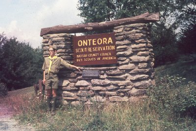
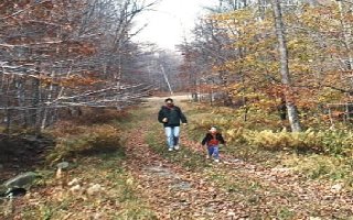
Entering the camp, we drive past
the sign next to the Ranger's house.
|
I cheated a little -- this picture
wasn't taken in 1998, it was taken in 1969. The young scout
standing next to the sign is me when I was 13 years old!
It's a better picture than the one
I had here originally, and it gives me a place to link to my old
scout pictures. Click here for
some pictures of Onteora from 1968-1971. |
| Down the hill and
through the parking lot, we come to the camp Administration
building. This was the site of the only link to the outside world,
a pay phone (remember this was in pre-cell phone days). The staff
lounge was in the basement behind the admin building.
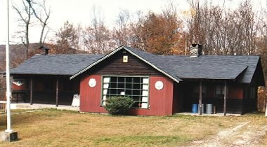 |
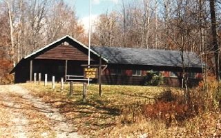
Just past the admin building is the
Health Lodge on the right. For the Scouts, the camp nurse was the
last female you saw before visitor's day, the middle Saturday of
each camp period. If you were lucky, you saw the nurse when you
checked in, and then not again until next year. |
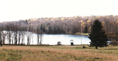
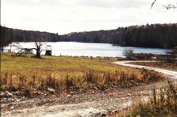
| On the left is the Parade Grounds,
and Orchard Lake is in the distance. In the late 1960's, the near
shoreline was the location of the Buckskin waterfront. My troop
used this waterfront in 1968, and I still remember the murky
water and muddy bottom. The Chiefs and Tribes waterfronts, on the
right shore as seen in these pictures, were more in the stream's
current and didn't suffer this problem, although the water was
much colder there. (Remember the stream feeding this lake is a
trout stream!)
 |
The road curves around to the right
and starts uphill past the Trading Post. The Tuttle House, which
used to be on the right side of the road here, was gone. Only a
foundation remained.
|
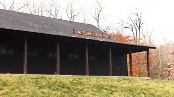
The Long Island Trading Post.
Nobody ever called it that. It was just the Trading Post or
usually "the PX". The PX could be a big distraction, so
we were limited as to when we could go there. We were usually kept
pretty busy in camp, so this wasn't a problem. |
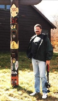
Dave next to the Trading Post. You
could get candy, soda, post cards, and all kinds of Scouting stuff
here.
 |
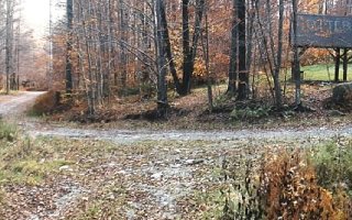
| Continuing up the hill past the
On-On-Tio camp site, we come to the Otter Shelter. I stopped and
took a picture looking back down the road we just came up (on the
left). The road to the right curves up the hill to the water tower
and the Long House. The road behind the photographer leads up to
the Council House.
 |
This shot is taken from the same
spot as the previous photo, but looking in the opposite direction.
Up the hill is the Council House, now in disrepair. You can see
the flag pole in front of the Council House leaning over in the
center of the picture. Lets take a look at the Council House. |
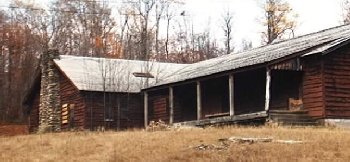
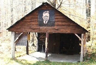
| The Council House. It was sad to see
it all boarded up.
 |
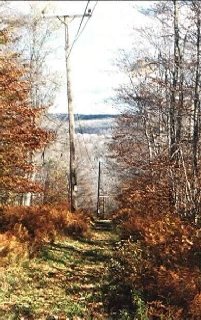 Back
down to Otter and then up the road towards the water tower. With
our backs to the water tower, here is the view looking down the
Power Line Trail. It's still as steep as I remember it! Back
down to Otter and then up the road towards the water tower. With
our backs to the water tower, here is the view looking down the
Power Line Trail. It's still as steep as I remember it! |
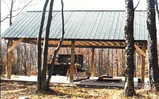
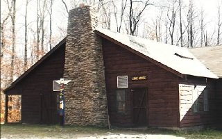
| Next to the water tower is the James
E. West shelter. It was being rebuilt while we were there. One
year the Conservation Shelter I worked at was just across the road
from here, which is the present site of the Buckskin Craft Lodge.
 |
We walked down the road next to the
Power Line Trail, past the Buckskin Craft Lodge and then looped
around to the right. Many of the old camp sites are gone.
Eventually we came to Teddy Roosevelt Shelter, surprisingly
intact.
 |
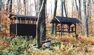
| Here is a familiar sight. Sometimes
this was the only way to tell the location of a camp site.
 |
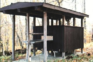
Taking a closer look (but not too
close), it appears that the old "hole in the ground" has
been replaced by an underground holding tank of some sort.
|
| Last stop, the Long House. While we
were there, the ranger was busy shoring up the roof. It's in pretty
bad shape. We looked around inside and saw plaques on the rafters
dating back to the 1960's and 1970's. Dave even found some with
his name on them from his summers working in the Long House
kitchen in 1979 and 1980.
 |
I have more slides and pictures of
Onteora from the late 1960's and early 1970's. One of these days
I'll scan and post some here. Those were the glory days at
Onteora, when the camp was operating at full capacity for four
2-week camping sessions each summer. It's good to hear that, after
several years of being closed completely, summer camping returned
to Onteora in 1998. |